Introduction
Agriculture remains the backbone of Tanzania’s economy, employing over 65% of the population and contributing significantly to GDP. Yet, challenges such as erratic weather, pests, poor planning, and climate change continue to threaten food security. In recent years, Tanzania has turned to space-based technologies—particularly satellite imaging and remote sensing—to monitor agricultural patterns and improve food production systems. By integrating satellite data into national agriculture strategies, the country is enhancing its ability to make informed decisions and promote sustainable farming. This article explores how Tanzania is using space technologies to transform agriculture and strengthen food security across the nation.
The Agricultural Challenge in Tanzania
Tanzania’s agricultural sector faces persistent obstacles: unpredictable rainfall, outdated farming methods, limited access to real-time data, and land degradation. These issues are compounded by climate change, which has introduced increased frequency of droughts and floods. Traditional data collection methods—such as manual field surveys—are often slow and inaccurate, making it difficult for policymakers and farmers to respond quickly to changing conditions.
To counter these issues, Tanzanian authorities are embracing modern, data-driven approaches. Satellite technology offers a cost-effective and scalable way to monitor vast agricultural landscapes, assess crop health, and predict yields.
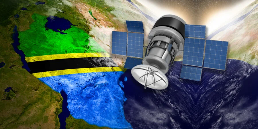
Integrating Satellite Monitoring into Agricultural Planning
Through collaboration with organizations such as the Tanzania Commission for Science and Technology (COSTECH) and international partners like the African Regional Centre for Space Science and Technology Education in English (ARCSSTE-E), Tanzania has begun integrating satellite data into national agricultural monitoring frameworks.
Remote sensing is being used to map farmland, identify planting trends, and track crop performance across different regions. This information is helping the government detect early signs of crop failure, pest infestations, and water stress—allowing for timely interventions such as targeted irrigation or pest control.
The National Food Security Division within the Ministry of Agriculture has also adopted geographic information systems (GIS) and Earth observation data for seasonal forecasting and food supply planning. These tools are vital in ensuring that national grain reserves are managed effectively and that emergency responses are timely during periods of scarcity.
Farmer Outreach and Capacity Building

While satellite data is powerful, its benefits depend on how effectively it reaches those on the ground. Tanzania is investing in outreach and training programs to ensure that farmers, extension officers, and local governments can interpret and apply the information provided by satellite systems.
Mobile platforms and local radio broadcasts are being used to deliver satellite-based weather updates, planting schedules, and market trends to rural farmers. In collaboration with NGOs and universities, data literacy workshops are being held to bridge the gap between high-tech monitoring and practical farming decisions.
Initiatives like the SAGCOT (Southern Agricultural Growth Corridor of Tanzania) are also incorporating remote sensing data into regional planning to enhance productivity and sustainability.
Future Prospects and Regional Collaboration
Tanzania’s approach to using satellite technology for agriculture positions it as a leader in digital farming in East Africa. Looking ahead, the country plans to invest further in satellite infrastructure and explore partnerships with space agencies in Kenya, Rwanda, and Ethiopia to improve data access and share expertise.
There is also potential to integrate artificial intelligence and machine learning into satellite analysis, enabling more precise forecasting and long-term climate modeling. These technologies can aid in crop diversification, land-use planning, and mitigation of food crises across the region.
Conclusion
Tanzania’s embrace of space-based agricultural monitoring is a significant leap toward modernizing its food systems. By leveraging satellite imagery and data analytics, the country is improving its ability to predict and respond to agricultural challenges in real time. This proactive approach is not only securing food supplies but also supporting rural development and climate resilience. As Tanzania continues to scale up its efforts, its model can serve as an inspiration for other East African nations seeking to merge space technology with food security strategies.

